Accuracy assessment is an important step in the production of any remote sensing-based map, and was a major component in the production of the ABMI Remote Sensing Group’s Wall-to-Wall Alberta Land Cover Map version 2.1 (circa 2000). Assessing the accuracy of a province-wide map is no small task, particularly when the map is not a traditional pixel-based classification, but rather a polygon-based vector layer containing millions of polygons. Nevertheless, University of Calgary (U of C) alumnus Chunhua Zhang rose to the challenge while completing her Masters in Geographic Information Systems (MGIS) degree in the Department of Geography at the U of C. Co-supervised by Greg McDermid and Guillermo Castilla in the Foothills Facility for Remote Sensing and GIScience, Chunhua’s project focused on developing an efficient, semi-automated approach to accuracy assessment that enabled standardized data processing, data management, and analyses of the different aspects of accuracy.
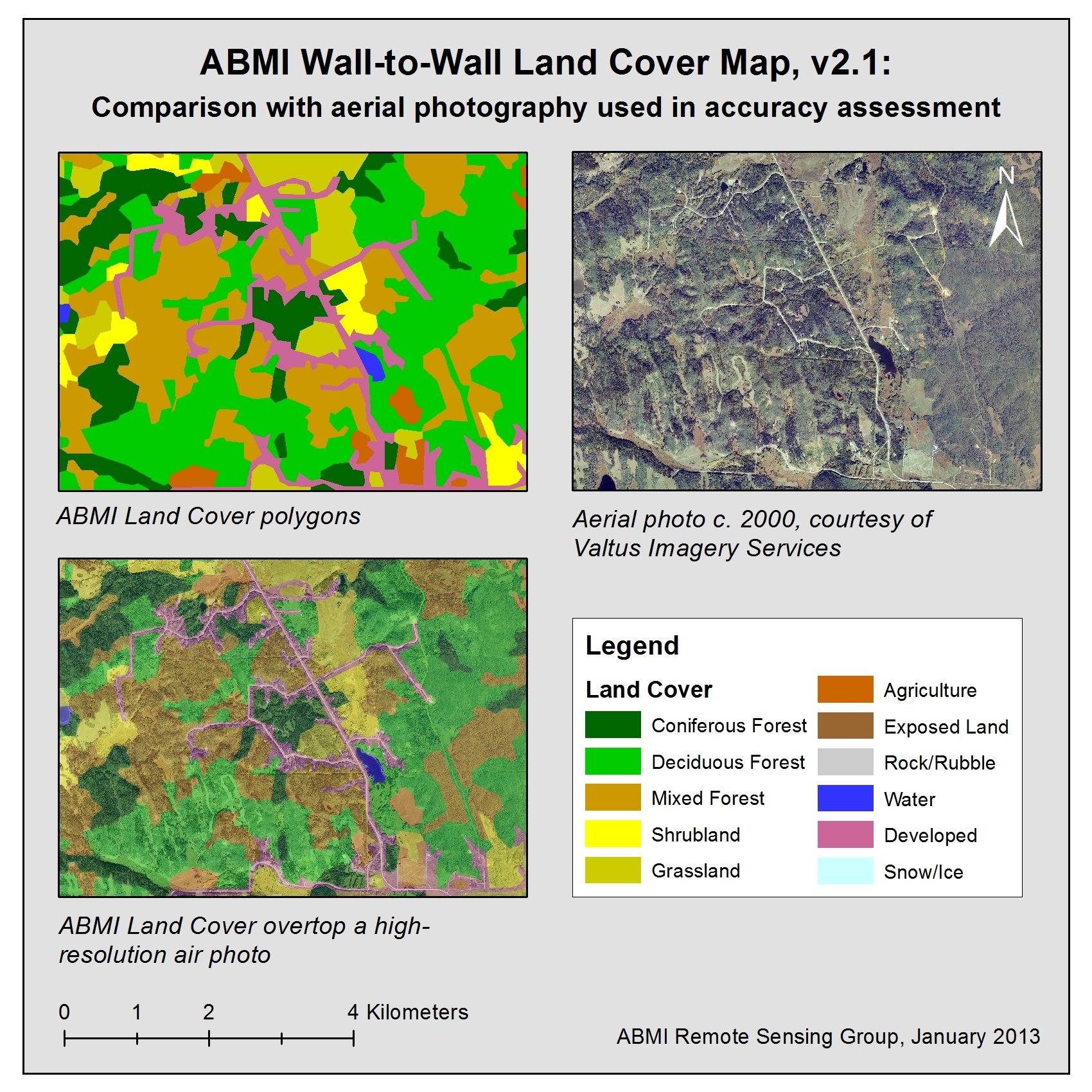
Assessing the accuracy of a remotely-sensed map product generally consists of comparing portions of the product with a reference data set of high, known accuracy in order to evaluate the level of agreement between the two. In the case of the ABMI Wall-to-Wall Land Cover Map, this involved visually assessing land cover in a random subset of polygons from the map using very high-resolution aerial digital photographs, through a methodic set of GIS operations that Chunhua nicely streamlined using the tools available within ESRI’s ArcGIS software. This included the semi-automatic set up of an interpreter‘s project in ArcGIS (e.g, loading the layers with a pre-determined symbology); arranging the data entry and geometric correction tools; navigating automatically from one polygon to the next; generating automatic screen captures for quality control; and performing automated analyses leading to the calculation and summary of accuracy statistics. Chunhua’s standardized workflow helped to reduce the necessity for manual input, guide the collection of reference data, and maintain consistency throughout the process.
By using Chunhua’s workflow, the ABMI Remote Sensing Group was able to generate a gamut of accuracy parameters for their land cover product. The 11 classes provided in version 2.1 of the product show an overall thematic accuracy of 75%, which increases to 88% when land cover classes are grouped into 5, more general classes. (See the full accuracy report for more information, available on the ABMI website.)
Chunhua completed her MGIS program at the end of summer 2012, after having arrived in Calgary from China just two years before. She says that she is very grateful for the opportunity to work with the ABMI team, which has been a wonderful experience, and has taught her to be a critical scientist. Chunhua is now in Australia, pursuing a Ph.D. She will be greatly missed by her friends and colleagues here at the University of Calgary.