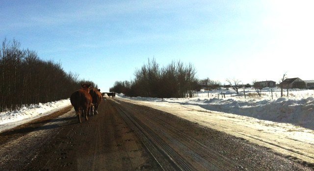
In early January, Brandi Mogge, Land Access Manager for the Alberta Biodiversity Monitoring Institute (ABMI), headed to southern Alberta from the ABMI’s offices at the University of Alberta in Edmonton on her first trip to visit landowners and request access to their land. She was prepared to spend her week formally explaining why the ABMI exists and how it operates, reading through piles of documents, and answering technical questions. “I expected to be in more of a teaching role, trying to explain the ABMI’s protocols, for example” says Brandi. “As it turned out, I found myself learning at least as much as I taught. Meetings that started with a handshake and a speech often ended after several cups of coffee and an exchange of stories spanning generations. I came away appreciating landowners as stewards of the land.”
The ABMI tells the story of Alberta’s plants and wildlife. To do this, the ABMI measures and reports on changes in biodiversity at 1656 sites systematically located — every 20 km — across the province. In 2013, the ABMI plans to survey 240 sites. Forty percent of these sites are found on private land, all of which the ABMI seeks permission to access. “Alberta landowners play such a huge role in our research,” explains Brandi. “Not only do they provide us with the essential access to private property, but they teach us about their relationship with the land, the importance of being good land stewards, and the changes to their land that they’ve already witnessed.”
The ABMI takes land access seriously: without the cooperation of private landowners, biodiversity monitoring would not be possible. All reasonable effort is made to ensure landowners are fully aware of the ABMI’s monitoring activities and that they feel comfortable with ABMI field technicians visiting their property.
Every winter, land access coordinators contact landowners to introduce themselves and explain why the ABMI wants access to their land (see below for a description of what the ABMI measures at each location). From January to April, the coordinators travel throughout the province to meet landowners in person to discuss access rules and requests. These could include areas of the property to avoid walking on, suggestions about trails to drive on, or requests to have survey crews call the landowner when they are leaving the property. Prior to the beginning of the spring field season, with site-specific information packages, the coordinator communicates these access requests to the ABMI field technicians to ensure they’re implemented. And finally, a week prior to the ABMI’s arrival on their land, the access coordinator calls landowners again to remind them of the ABMI’s visit.
Regardless of whether the ABMI plans to directly monitor the land or simply walk through it to reach a survey site, the land access team contacts all landowners and leaseholders. “We want to be open, honest and clear about the ABMI’s goals,” says Brandi. The ABMI also recognizes the importance of protecting landowners’ information. All data is reviewed before it’s entered into the ABMI’s public database to ensure identifying features, such as exact site location and landowner names, are removed. The data is then published on the ABMI website so that all Albertans can enjoy the benefits of the Institute’s province-wide biodiversity research. “Although our goal at the ABMI is to make biodiversity information readily available,” explains Brandi, “we work hard to to strike a balance between sharing knowledge and landowner confidentiality.”
The land access team’s goal is to visit all landowners; it’s disappointing when face-to-face meetings don’t work out. “We want to know the people who give us the ability to study biodiversity in the province. There’s something special about visiting people at home, work, or the local coffee shop and getting to know them personally.”
For landowners, an ABMI survey is also a lot to be excited about. “Not only do we want people to know what the ABMI is doing,” says Brandi, “but we hope they’ll get excited about it.” Approximately one year after the ABMI field crews complete their work, landowners receive a personal report describing the species and habitat characteristics found on their property. “One couple used our report as a guide to help them identify birds from their porch” remembers Brandi. “Apparently, the report helped them figure out one new species they hadn’t seen until that summer.”
The ABMI recognizes that not every Albertan owns property; however, the public has a stake in the majority of the province’s land. “Over half of our province is crown land, owned by the public,” says Brandi. “It’s our responsibility as Albertans to know what we have living on our land and to pay attention to how it’s changing.” The ABMI’s public database gives all residents the opportunity to observe potential changes in the province’s landscape and look up information on species they’re interested in.
At each location, the ABMI monitors a terrestrial site and a nearby wetland.
Wetland sites: Wetland sites are assessed in May to determine the best point of access and to verify the water body meets the ABMI’s specifications (e.g. must be at least 1 metre deep). Crews return to sites in late June and July to perform surveys, which includes shoreline vegetation mapping and identification, collecting water samples to measure nutrient levels and pH, and sampling of freshwater invertebrates.
Terrestrial sites: Site establishment occurs in May, when crews set-up a complex grid of flagging tape in a one-hectare area. Spring protocols are performed in late May or early June and include a breeding bird survey, as well as data collection on habitat characteristics such as elevation, slope, and ecosite definition. A third visit takes place in late June or July to perform summer protocols, which includes soil sampling, tree aging, canopy cover measurement, and a bryophyte (moss) and lichen survey.
Photo: (c) Brandi Mogge. Photo caption: Cows on roadway on recent land access trip.

