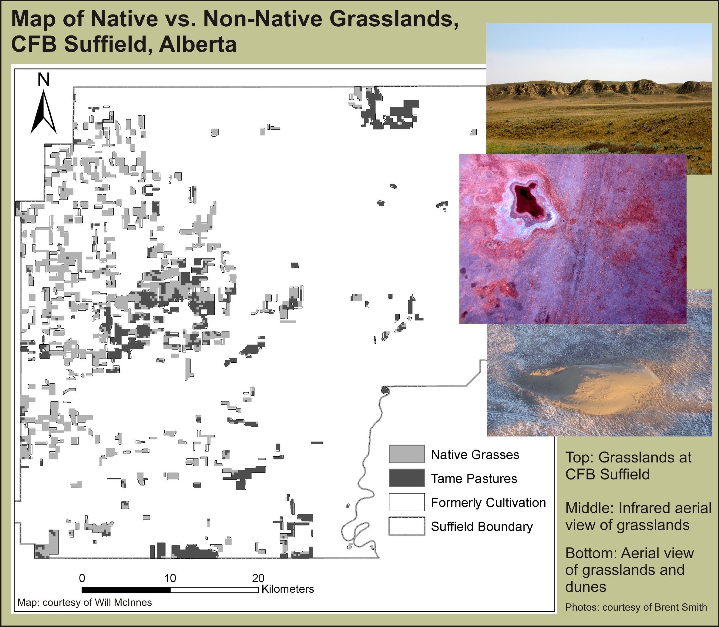
Will McInnes is a recent graduate of the University of Calgary’s Masters in Geographic Information Systems (MGIS) program in the Department of Geography, and author of an ABMI-funded MGIS thesis project that successfully tested a multi-temporal remotely-sensed data set in the mapping of native vs. non-native grasslands over several different Albertan prairie subregions. An expansion of previous work done by Brent Smith (Range Biologist, CFB Suffield), Will’s work showed how the diverse phenologies of these two grassland types and the use of existing multi-date satellite imagery could enable more accurate separation of these types for classification maps in grassland areas of the province. We asked Will to describe the project to us in his own words. Here’s what he had to say:
“I’m sure I don’t have to spend too much time explaining the importance of mapping native and non-native species with this group! We were interested in mapping native and non-native grasses in Alberta because it helps with identifying species habitat, range health, and biodiversity. The problem is that native and non-native grasses look very similar – especially when you are looking from a satellite orbiting 700 km above the earth.
If we look at planted pastures and native grasslands side by side at any given time of year, it can be very difficult to tell them apart. However, it turns out that if we compare the phenology – or seasonal nature – of the two types of grasses, we can tell them apart based on how they green-up. We found that if we compared MODIS satellite sensor images over time, the introduced grasses were seen to green-up earlier than the native grasses, thus enabling us to separate the two groups based on the statistical differences we observed in the spring. Our method performed better than other traditional remote sensing classification methods, both at CFB Suffield, and in three other prairie natural subregions in the province.
While it is true that remote sensing-based mapping does not produce the high levels of detail obtained by identifying species by hand in the field, it does save a lot of time and money, and complements these ground efforts nicely with more extensive spatial coverage. Our method will be especially useful for separating two classes that have been traditionally been very difficult to separate with image classification. We hope this work will help the ABMI in monitoring biodiversity of grasslands across Alberta.”
If you are interested in learning more, you can reach Will by phone or email at the University of Calgary, where he is currently working as a research technician for the Crown Managers Partnership. Phone: 403.220.8289. Email: wssmcinn@ucalgary.ca