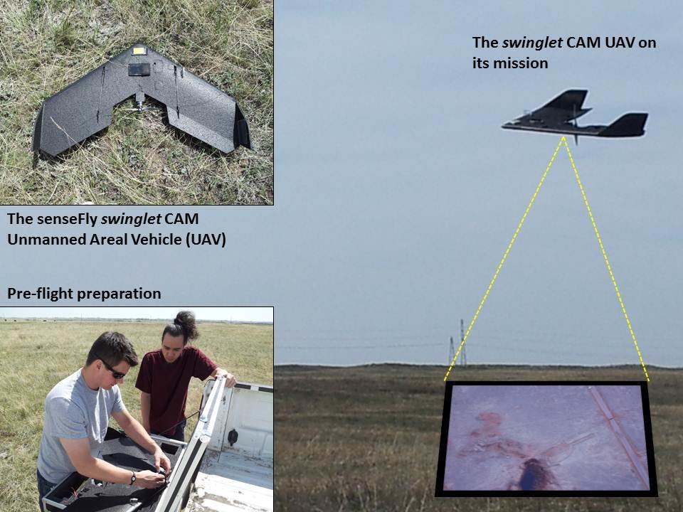
While remote sensing is presently an activity that we think of as taking place primarily on large aircraft or spacecraft, recent happenings in The Foothills Facility for Remote Sensing and GIScience (F^3GISci; home of the ABMI Remote Sensing Group) offers a glimpse into the discipline’s future. The group has recently added a senseFly swinglet CAM Unmanned Areal Vehicle (UAV) to its in-house inventory. The swinglet CAM UAV is a ready-to-deploy mini drone, mounted with a high-resolution Canon Powershot 12.1 megapixel false-colour composite (near-infrared/red/green) camera. The artificial intelligence incorporated in the senseFly autopilot continuously analyzes data from the Inertial Measurement Unit, and the onboard Global Positioning System takes care of all the aspects of the flight mission. The swinglet CAM UAV’s design allows airborne remote sensing studies at high spatial and temporal resolutions. The group is currently deploying the UAV to study grassland phenology in order to differentiate native and non-native grassland species.