ABMI Remote Sensing Scientist Jen Hird presented as part of Google Earth Outreach’s Geo For Good lightning talk series on January 27. This event has now ended.
Across the field of biodiversity monitoring, technological advances are making possible new kinds of observation and analysis. Some of the biggest changes have come from the deployment of more and ever-better satellite-based tools and sensors, which have ushered in new ways of seeing and interacting with our world.
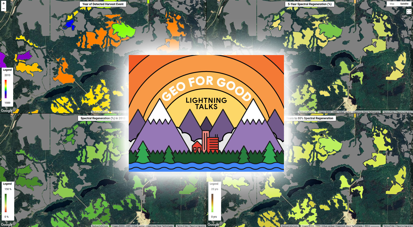
From human footprint to hydroperiod, the ABMI’s Geospatial Centre works with these novel technologies to better monitor Alberta’s landscapes. Often, the questions revolve around the impacts of human activities. ABMI remote sensing scientist Jen Hird, based out of the University of Calgary’s Applied Geospatial Research Group, is interested in the opposite side of that coin: What happens when human activities in an area come to an end? She’s advancing the emerging science of spectral regeneration, using Landsat imagery and Google Earth Engine to track the recovery of plant life after disturbances.
The idea is that as forests and vegetation communities grow and change, their spectral signatures as seen from space also change. Understand how changing spectral signatures relate to on-the-ground changes in a recovering forest, and you have a basis for monitoring forest regeneration simply and efficiently even over large areas. Jen’s short talk, part of a Google-sponsored series on the use of mapping tools in forest management, delved into preliminary results from well sites and reclaimed mine areas and looks ahead to the potential of using the method across Alberta.
Another attraction of this approach is that, despite seeming—and being—space-age, it relies on open-access imagery and cloud-computing platforms that can be accessed by anyone—including you if you visit the visualization tool Jen developed. So, even as biodiversity monitoring goes increasingly high-tech, its methods and outputs are more democratic than ever, something that Jen and her Geospatial Centre team highlighted in a recent paper. In fact, Jen has been working with citizen science group Forest Matters to explore how citizen-collected data on regenerating forests can complement her spectral work, an initiative that we’ll be highlighting in depth later this winter.
Meantime, we hope you’ll play around with the visualization tool to get a taste of this promising research!