The Alberta Human Footprint Mapping Program (AHFMP)—a joint initiative of the ABMI and the Government of Alberta—has recently completed a major update to Alberta’s Human Footprint Inventory. Over the next few months, we’ll be highlighting key elements of this comprehensive new dataset.
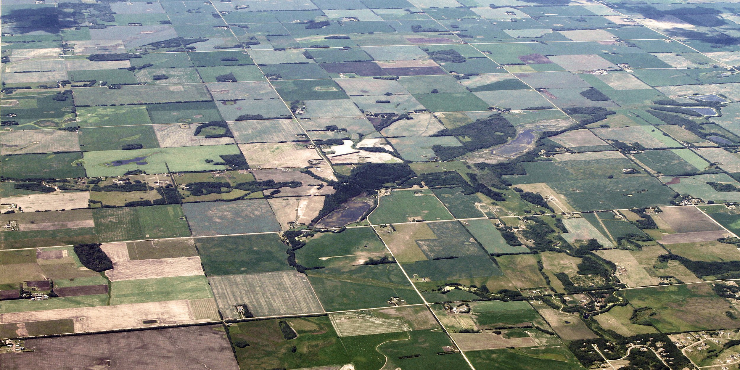
Human footprint is all around. Not the muddy kind in your front hallway; we’re talking about the other kind—the one that affects biodiversity and shapes landscapes across Alberta. If a native ecosystem has been visibly altered or replaced by anthropogenic activities or infrastructure, that’s human footprint. Understanding the extent and effects of human footprint is vital to creating land use plans, implementing effective land management policies, and tracking progress relative to set land use objectives.
In 2015, the ABMI partnered with Alberta Environment and Parks (AEP) to launch the Alberta Human Footprint Monitoring Program (AHFMP). Guided by a balanced group of representatives from government, industry, academia and environmental non-governmental organizations, the AHFMP aims to be the go-to source for standardized, open-access, and scientifically credible human footprint data for all Albertans. It’s also a great example of the benefits of collaborative science and knowledge translation.
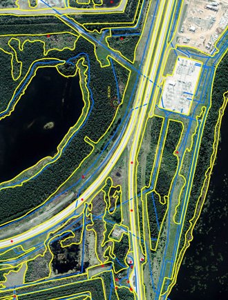
Identifying, outlining, and classifying human footprint is a labour-intensive process.
Documenting and mapping human footprint is a big job. As you can imagine, the pattern, composition, and extent of human footprint changes daily, and staying on top of these changes is a major part of providing accurate data. It can take years to identify, process, and verify land use, but the reward is a complete picture of human footprint in Alberta, from border to border. By bringing to the table all parties that collect and process human footprint data, the AHFMP leverages a wider range of input datasets and ensures that the final snapshot is as accurate as possible.
The ABMI has recently completed production of a new Human Footprint Inventory (2014 HFI) based on data collected through AHFMP efforts. This represents the most comprehensive and up-to-date data on human footprint currently available. Made up of 115 categories of footprint assembled from 21 sub-layers that span the province, the 2014 HFI includes exciting updates and new info. For example, the 2014 HFI has been upgraded to include more accurate boundaries of footprint whenever possible (e.g., enhanced well-site boundaries), rather than using a buffered approach based on average footprint per feature type. Plus, new categories have been added: for example, agricultural lands can now be designated as more than one category, including “crop”, “cultivation abandoned”, and others. We think these updates make the 2014 HFI more user-friendly, and more powerful, than ever.
The integrated (i.e., all sub-layers compiled into one layer for the entire province) 2014 HFI is already available on the ABMI website. Over the coming months, we’ll be featuring some of what we think is coolest about it right here on the ABMI blog. Soon, the ABMI will also be releasing individual AHFMP human footprint sub-layers, plus a new report, The Status of Human Footprint in Alberta, which will include additional data from the 2014 HFI and AHFMP human footprint sub-layers. We’re pleased that the AHFMP has yielded results already, and we hope you’ll stay tuned as we explore them.