We’re pleased to announce the release of the ABMI Alberta-wide Wetland Inventory—our most up-to-date and high-resolution wetland data yet. Several years in the making, this work would not have been possible without the generous support of Alberta Environment and Parks, or the rapid advance of remote-sensing technologies.
Thanks to the availability of incredible open-source data and the tools to process it, including cloud-based computing and machine learning, it’s now possible to ask and answer bigger geospatial questions than ever before. One area that can benefit from such advances is wetland mapping—an important step toward understanding and sustainably managing valuable wetland ecosystems. However, a complicating factor is that wetlands are dynamic, often transitional, and frequently remote, all of which make them hard to map. Because of this, wetland inventories, if they exist at all, are often fragmented, incomplete, or out of date in many jurisdictions around the world.
Until recently, Alberta had no single, standardized wetland inventory. Instead, the province was covered by a patchwork of local- or regional-level wetland maps and inventories ranging from coarse to highly detailed. This changed when the Government of Alberta combined regional data into the Alberta Merged Wetland Inventory (AMWI), covering most of the province. Even after merging, this dataset comprises various separate components generated through the efforts of many organizations using different data sources, standards, timelines, and methods. The ABMI Alberta-wide Wetland Inventory aims to complement the regional strengths of the AMWI by considering the entire province at once. It uses a consistent, remotely-sensed topographical approach from border to border, while remaining sensitive to important regional distinctions.
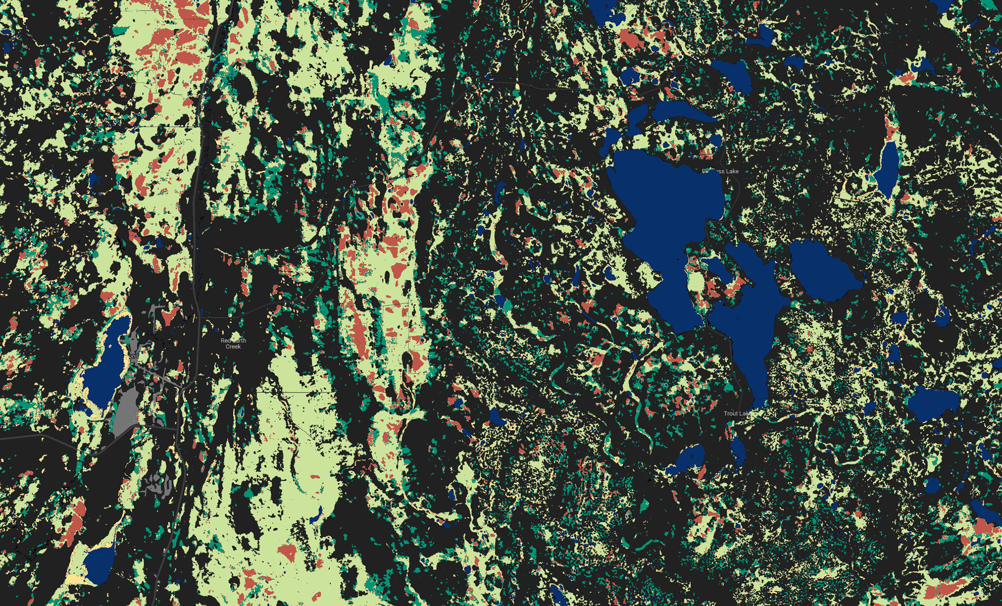
The ABMI Alberta-wide Wetland Inventory uses open-access Sentinel-1 and Sentinel-2 data in Google Earth Engine combined with machine learning to classify marshes, swamps, bogs, fens, open water, and upland areas for all of Alberta. Since a picture is worth a thousand words, check it out for yourself—we’ve set up an interactive preview version in Earth Engine Apps that lets you visually interact with the entire dataset.
Within this standardized approach, the ABMI Alberta-wide Wetland Inventory also recognizes that Alberta is a diverse province with distinct regional types of wetlands. With that in mind, we divided the province into three areas, each with optimizations to capture the area’s unique spatial and temporal wetland patterns:
- the boreal and foothills (characterized by large peatland and swamp complexes)
- the prairies (where wetlands usually occur in small seasonal potholes)
- the Rocky Mountains (where wetlands are constrained to narrow valleys)
Available for download—like always, for free to anyone—as both raster and polygon datasets, the complete ABMI Wetland Inventory contains a whopping 3,093,620 wetland polygons.
Going forward, we’re delighted to be working with Ducks Unlimited Canada and AEP to further improve and enhance wetland mapping. Stay tuned for some exciting developments from our collaboration as we work towards the next generation of wetland inventories in Alberta to meet AEP’s new wetland inventory standards and guidelines.
We look forward to continuing to build tools to help Albertans sustainably manage our living natural resources—together.